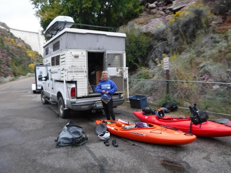
I’ve had this trip in the back of my mind for several years, but there have always been an almost
insurmountable number of obstacles: permits, shuttle, length of time and water levels to name a
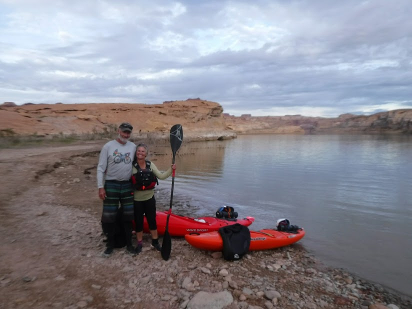
few. My wife and longtime adventure partner, Patti, and I had acquired a Liquidlogic XP9 and a
Wavesport Ethos and had done several shorter self-support trips over the spring and summer.
The advantage of these “crossover” kayaks is the large volume for comfort and storage capacity
and a retractable skeg for tracking in flat water. I thought that with a couple resupply stops, this
trip could be not only feasible but enjoyable. The idea bubbled to the top this summer when,
having obtained a Lodore late season permit for 10/1 when they were released in March, I saw
that the Flaming Gorge release forecast was for a 2500 c.f.s. average for the rest of the year.
This created a rare opportunity as fall releases are typically in the 800 - 1000 range and the
extra volume should simplify routefinding in the sandbar sections and provide helpful current.
With two pieces of the puzzle in place I began watching recreation.gov for a Desolation
cancellation and managed to get a 10/7 permit. With the help of Ed and Mellanie at River
Runners Transport to arrange some of the shuttle and resupply logistics, we had a pretty
good plan put together well in advance of our 9/29 launch at the Spillway Ramp, planning
to paddle 25 miles per day with resupply stops in Vernal and Green River.
insurmountable number of obstacles: permits, shuttle, length of time and water levels to name a
few. My wife and longtime adventure partner, Patti, and I had acquired a Liquidlogic XP9 and a
Wavesport Ethos and had done several shorter self-support trips over the spring and summer.
The advantage of these “crossover” kayaks is the large volume for comfort and storage capacity
and a retractable skeg for tracking in flat water. I thought that with a couple resupply stops, this
trip could be not only feasible but enjoyable. The idea bubbled to the top this summer when,
having obtained a Lodore late season permit for 10/1 when they were released in March, I saw
that the Flaming Gorge release forecast was for a 2500 c.f.s. average for the rest of the year.
This created a rare opportunity as fall releases are typically in the 800 - 1000 range and the
extra volume should simplify routefinding in the sandbar sections and provide helpful current.
With two pieces of the puzzle in place I began watching recreation.gov for a Desolation
cancellation and managed to get a 10/7 permit. With the help of Ed and Mellanie at River
Runners Transport to arrange some of the shuttle and resupply logistics, we had a pretty
good plan put together well in advance of our 9/29 launch at the Spillway Ramp, planning
to paddle 25 miles per day with resupply stops in Vernal and Green River.
Spillway to Lodore
(ABC/Browns Park) mile 0 - 47 9/29 - 10/1
Our first two days were rainy but we made good time through the class I and II ABC section and
flat Brown’s Park, camping at an improved site above Swallow Canyon. I was a bit surprised that
we had never considered adding this 47 mile section to one of our many previous Lodore trips,
as the scenery is beautiful and camping more than adequate at improved sites and on sandbars.
A SW wind picked up in the afternoon in Brown’s Park, but was only an annoyance on westerly
reaches of the river.

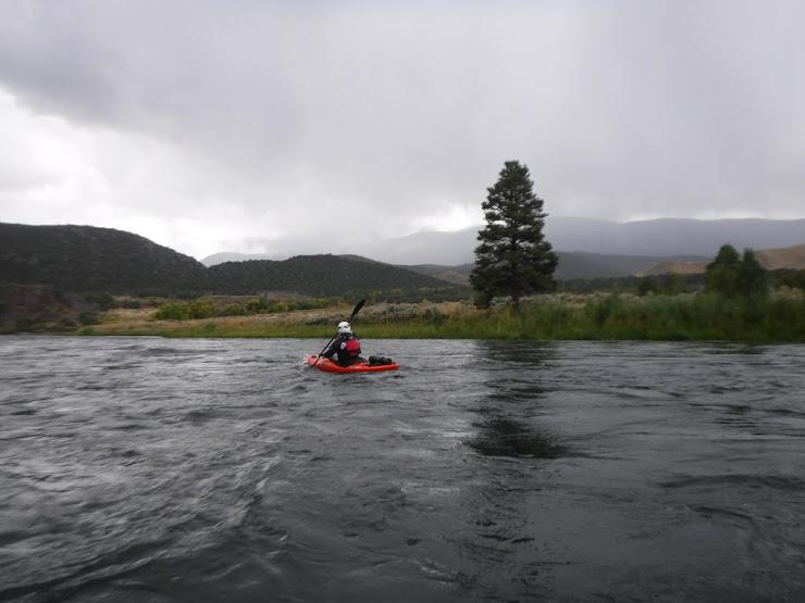
Gates of Lodore
(Lodore Campground to Split Mtn.) mile 47 -89 10/1 - 10/3
The plan was that my brother Ron and three other friends planned to join us at Lodore for the 43
mile run to Split Mountain. Upon arriving at Lodore, Pete met us at the ramp asking if we had seen
the weather forecast. The last one we had two days earlier was for generally improving conditions,
so we were surprised to learn that the area was in for a major early season snowstorm for the next
two days. We were all pretty lightly equipped for self-support and delaying our departure wasn’t an
option under the terms of the permit, so after kicking options around over a campfire and ethanol
antifreeze we went to bed reluctantly planning to cancel the Lodore leg, skipping the next 43 miles
and catch a ride with Pete to Vernal the next day. We have done this section countless times and
decided that the sufferfest just wasn’t worth the bragging rights of doing the whole thing.
Vernal
Camp Econolodge for a night of clogging the shower drain with sand/mud and drying
sodden kit. A visit with Ed and Melanie at RRT, picking up some some SealSkinz socks,
outrageously expensive but well and truly the best piece of paddling gear I own. A night
at the Split Mtn. Campground to grill up a couple steaks to fatload for the upcoming freeze
dry diet.
sodden kit. A visit with Ed and Melanie at RRT, picking up some some SealSkinz socks,
outrageously expensive but well and truly the best piece of paddling gear I own. A night
at the Split Mtn. Campground to grill up a couple steaks to fatload for the upcoming freeze
dry diet.
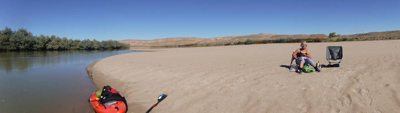
Uinta Basin
(Split Mtn. to Sand Wash) mile 89 - 121 10/3 - 10/7
I had been sort of dreading the Uinta Basin leg of the trip. 102 miles of flatwater through mostly
agricultural landscape with a good possibility of headwinds. To our surprise, the wind remained
mostly calm and camping on large and plentiful sandbars under a full moon was a highpoint of
the trip. Geese and Crane were migrating and we saw the occasional deer, coyote and beaver.

agricultural landscape with a good possibility of headwinds. To our surprise, the wind remained
mostly calm and camping on large and plentiful sandbars under a full moon was a highpoint of
the trip. Geese and Crane were migrating and we saw the occasional deer, coyote and beaver.


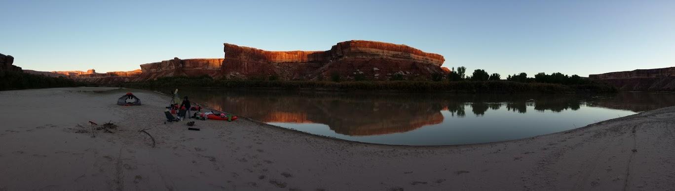
Desolation/Gray Canyons
(Sand Wash to Swazeys Beach) mile 191 - 272 10/7 - 10/10
I think Powell was mistaken about Desolation Canyon. With its Pinion, Mtn. Cedar and
occasional Fir, it was verdant compared to lower and dryer Gray Canyon and the sterile
Cataract. We had rowed Desolation in our 16’ NRS self-bailer in October of 2000 with
our then 4 year old daughter, Jessica, into a constant 15 - 25 mph headwind for 5 days
and I vowed I would never row it again; fortunately I was paddling this time. The only
noticeable headwind was on 10/8 in advance of a cold front which would bring an all
night rain and snow to the ridgetops. The current and II/III rapids brought easy miles
and an average moving speed of 6.4 mph, compared to our earlier 5 mph. We broke
our preference for camping on unnamed sandbars in favor of the protection of an unnamed
camp below Rock Creek Ranch on 10/8 and Rabbit Valley on 10/9.

Green River, UT
Our truck was waiting for us at Swazeys Beach Boat Ramp with provisions for the final
leg. This was a crucial resupply as Green River has no liquor store and we have become
very fond of Irish Creme as a coffee sweetener. In addition we needed internet to catch
up on some business, and Ray’s Tavern to catch up on burger and fries (puts Milt’s in
Moab to shame). So we spent 2 nights at Shady Acres RV park doing laundry/internet/
showers and an afternoon at the Powell Museum.
Labyrinth/Stillwater Canyons
(Swazeys Beach to Spanish Bottom) mile 272 - 407 10/12 - 10/16
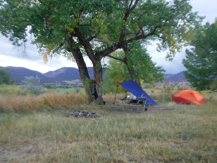
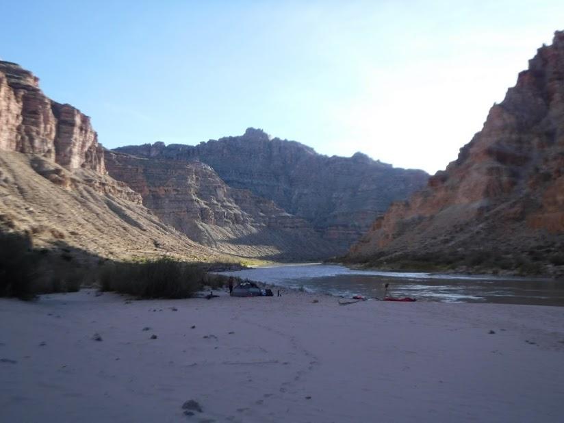
By this time we were looking forward to a return to pristine sandbar camps with early
and late sun to dry gear and melt the early morning frost. Our 25 mile/day pace required
6 - 7 hours on the water, while camp chores of gathering/sawing driftwood, settling/
filtering water, setting up the tent/pads/bags and rehydrating meals left little time for
drinking all the beers I’d managed to pack into the leftover nooks and crannies of my
kayak.
Tusher Dam boat passage was a clean shot despite the sign above the entrance saying
it was closed.
it was closed.
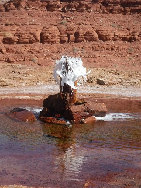
Crystal Geyser strutting her stuff.
Results of a windy night at Tenmile Camp
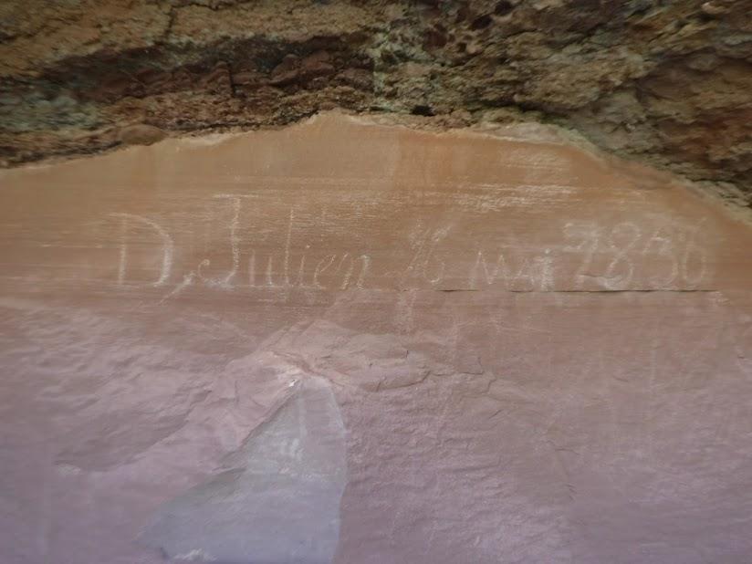
Denis Julien was a fur trapper who left several inscriptions along the length of the Green
River (among other places) in the early 1800’s.
River (among other places) in the early 1800’s.

Always amazed me that the Ancient Ones could build these and fill them with produce,
all without the benefit of sticky rubber.
all without the benefit of sticky rubber.

During the first half of the trip I tested a firepan that I had made, following a Boyce Greer
design made from 11 gauge aluminum and then a titanium sheet prototype firepan
designed by Tom W. during the second half, comparing the two. Mine came in at 9 lbs.
and was fiddly putting together with carriage bolts and thumbscrews. Tom’s was about
1.5 lbs. and snapped together quickly with aluminum rods. In addition, Tom’s rolled up
and stored in an ABS case that I cobbled together, that doubled as an ash container.
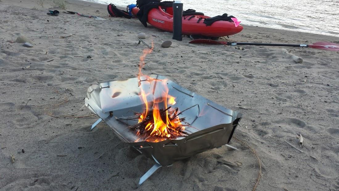
Interestingly, Dinosaur is the only permit that allows you to strain and carry only the
unburnt charcoals, using them at the next camp. This
unburnt charcoals, using them at the next camp. This
is a really elegant solution to the ash problem for the self-sustained traveller, which I
adopted for the entire trip.
adopted for the entire trip.
Cataract Canyon
(Spanish Bottom to North Wash Boat Ramp) mile 407 - 450 10/16 - 10-18
Cruising in to Spanish Bottom after a long 30 mile paddle, we were hailed by a young
solo boater, Austen, who asked if we were continuing down the river and wondering if
he could join us. We were tentatively planning to lay over and hike the Dollhouse, but
after a check of the weather forecast decided to proceed without the layover, to avoid
southerly winds forecast for later in the week.
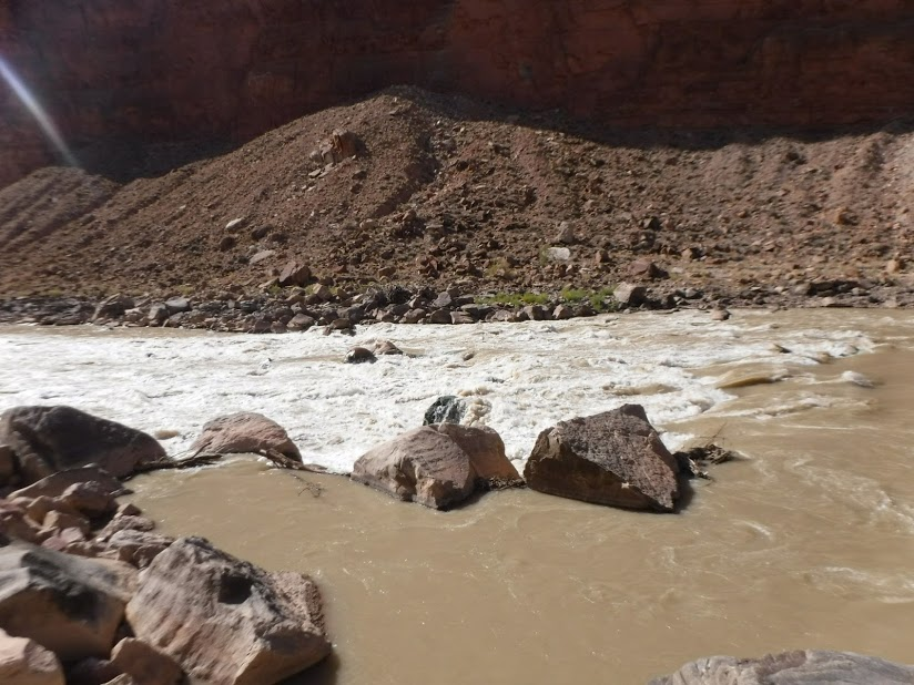
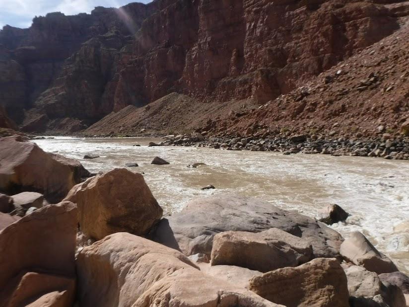
The flow was about 7,200 c.f.s., a relatively low level. This was the first time down for
all of us and I was expecting Grand Canyon style boating: pushy big wave poolanddrop,
but generally pick your entrance to a straightforward line with 1 or 2 rocks and holes to
avoid. The reality was pushy poolanddrop, but technical lines with multiple rocks and
sticky holes to avoid - generally more difficult than the Grand, at least for kayaks, at this
level.
Big Drop 3
We scouted Ben Hurt and found both sides of the island runnable (the left easier),
Big Drop 2 and Big Drop 3. It turns out we should have also scouted lower BD 2; it
looked very minor from above (200 yards down in the photo left), but the left side turned
out to be a maze of rocks and pourovers that resulted in a nasty little swim for Patti.
Big Drop 2 and Big Drop 3. It turns out we should have also scouted lower BD 2; it
looked very minor from above (200 yards down in the photo left), but the left side turned
out to be a maze of rocks and pourovers that resulted in a nasty little swim for Patti.
Upper Ten Cent Camp
We found decent camps as far down as Gypsum, and Dark Canyon was a little muddy
with a steep bank but usable. Deadpool seemed to start about Bowdie Canyon, but
bubble tracks could be seen all the way to the bridge. The paddle out from Upper Ten
Cent took us about 8 ½ hours with a couple short breaks and lunch at Dark Canyon.
with a steep bank but usable. Deadpool seemed to start about Bowdie Canyon, but
bubble tracks could be seen all the way to the bridge. The paddle out from Upper Ten
Cent took us about 8 ½ hours with a couple short breaks and lunch at Dark Canyon.
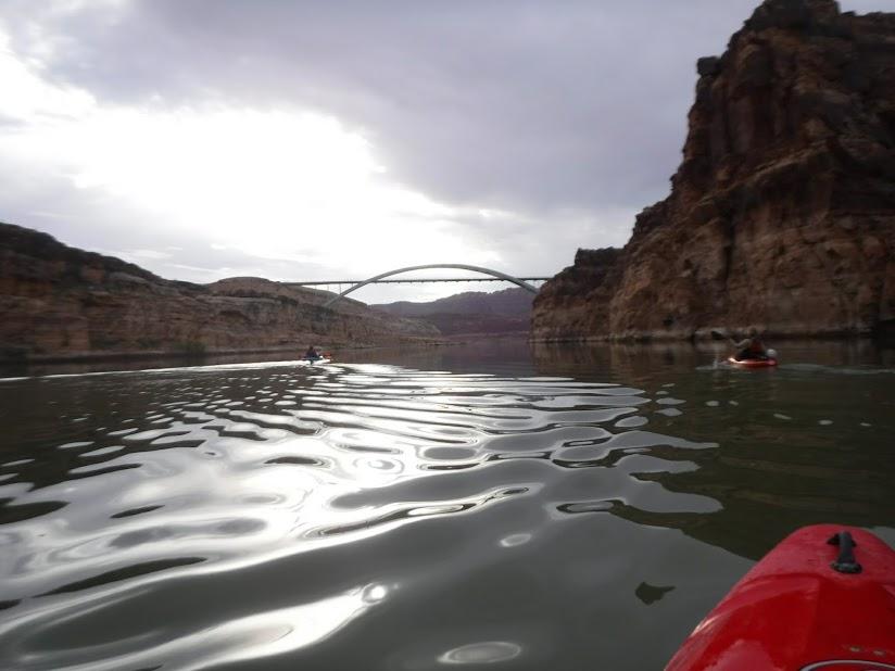
North Wash boat ramp
Summary:
Many things about this trip were the result of fortuitous circumstances, such as the water
level and the permits. But I think there is a niche for this type of “expedition” style
self-support trip where crossover kayaks may be best craft currently available. While
all boats are a product of design compromise, the combination of capacity, comfort, speed
and versatility worked very well for us in this setting.
Our planned itinerary of 25 miles per day was a little optimistic in retrospect, or maybe
he years are just catching up to us. I’ll probably be a little more conservative in the future,
with shorter distances (or daily time on the water) and more layovers.
he years are just catching up to us. I’ll probably be a little more conservative in the future,
with shorter distances (or daily time on the water) and more layovers.
Rick and Patti Miller
Golden, CO
10/22/2017
Trip Stats.:
Distance: 407 miles
Moving Time: 75 hrs., 22 mins.
Moving average: 5.4 mph
Paddling days: 17
Avg. Miles/day: 23.9
Permits: 7
Beers: 37
Avg. beers/day 2.18
Trip Planning:
I put together this spreadsheet with distances, itinerary, regulations summaries and
resource links.
resource links.
GPS Waypoints:
Here is a GPX waypoint file compiled primarily from rivermaps.net, also containing
observed campable sandbars and our camp locations.
observed campable sandbars and our camp locations.
Comments
Post a Comment